We really want to explore as many new islands/countries in the Eastern Caribbean this year as possible. We know that we won’t make it all the way down the chain to Grenada – since we need to be back in Florida before August, but we want to make it some distance. We (arbitrarily) set our sights on Antigua as our southern most destination and turning around point. Before heading south, though, we first need to head east. This is the most difficult direction to travel due to the trade winds coming out of the east, fighting against you. If we can make it to St. Martin, we should have an easier time heading southeast down the islands towards Antigua. So off we go.
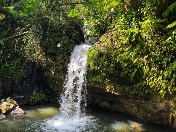
Back to Vieques
Vieques is only 30 miles from the marina in Palmas Del Mar (mainland Puerto Rico), but boy is it a hard fought 30 miles. The easterly trade winds here have just been relentless. We have been tied up to a dock for much too long, though – we’re setting off. The wind and waves are on our nose (aren’t they always?), so we are motoring along at a painfully slow 5 miles per hour. Our goal isn’t really to get to Vieques, rather it is to get to St. Martin – but that’s 200 miles away, so we’re trying to break it up and best time our travel with an upcoming short break in the trades.
We motor into our destination anchorage at Vieques a little before dusk. We skip the terrible spot we dropped the hook last time during our visit to the bio bay, and continue a few miles further to a much, much more protected spot. As we enter the large bay, we know we will actually be able to get a good night’s sleep tonight. It is very calm and serene. A neighbor comes by to welcome us to the anchorage and we spend a while swapping stories about places visited and places yet to go. After cooking up some dinner, we call it an early night as we know the next two days of travel will be at least as grueling (and definitely further!).
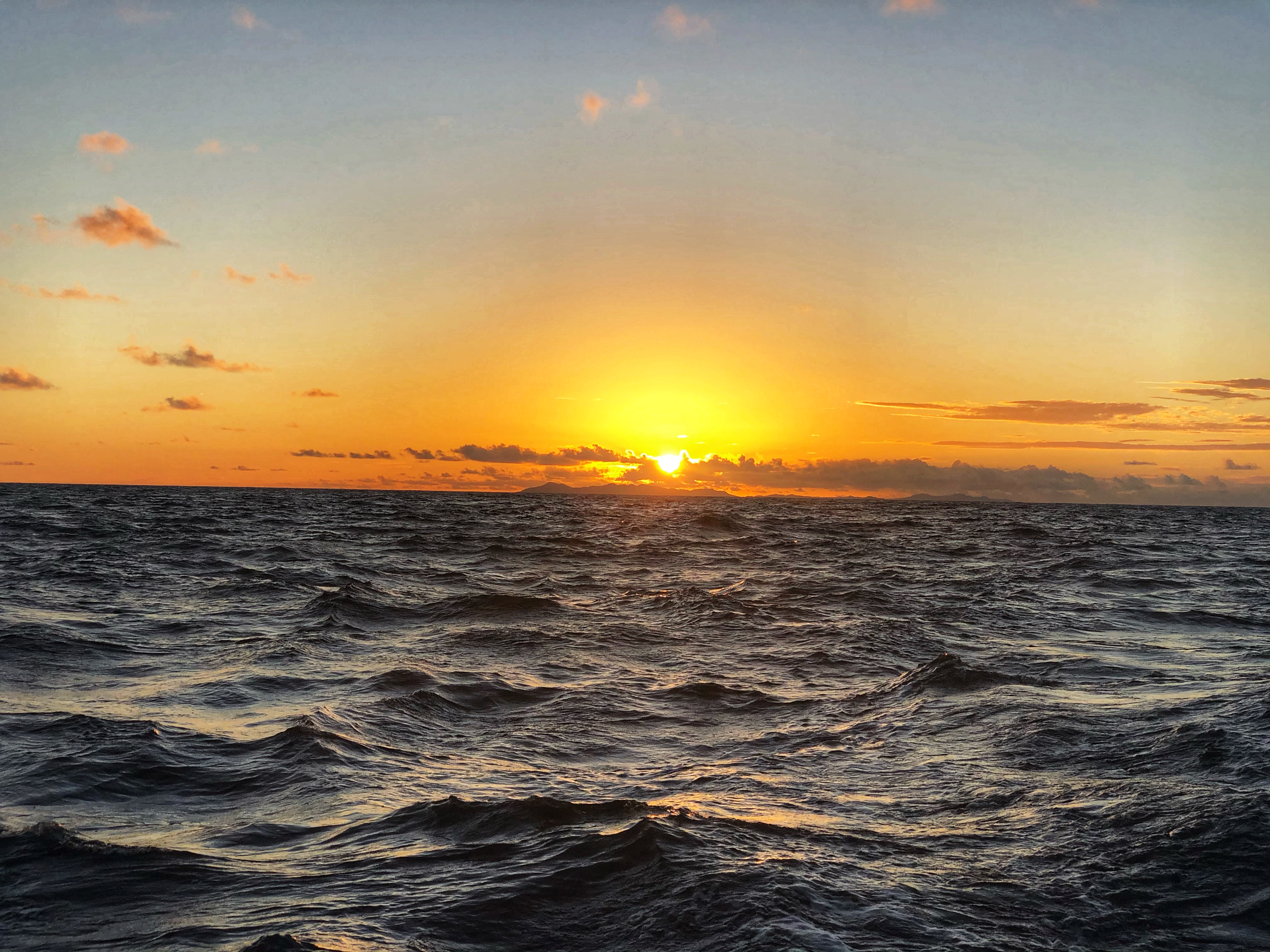
We wake up a bit before sunrise, getting ready to head out on another bumpy passage over to St. Croix in the US Virgin Islands. Today we have 55 miles to go; typically what we’d consider an “easy” day – not the case this time. At least we had a gorgeous sunrise to start the day off on a good note.
Atlantic spotted dolphins
About half way through our passage to St. Croix, I spot a dolphin off our starboard side. Of course, this ensues excitement and a bit of panic to spot more. Matt carefully makes his way towards the bow and is surprised to see not just a couple more, but a LOT more dolphins swimming along with our boat. I carefully make my way up front with Monster in my arms – it’s too rough for her to walk on her own. Of course, neither of us brought a phone/camera with us – you never have one when the best stuff happens.
At the risk of missing out on more dolphin time, I make my way back to the cockpit to grab a phone and to lock Monster inside the salon. Unfortunately, it’s too rough, the door won’t stay shut and I definitely don’t trust the little munchkin to stay inside on her own (or walk around the boat alone no matter how great she thinks her balance is). The dog goes in her bag across my shoulder and we head back out with the phone. Matt is in charge of getting awesome video while Monster and I carefully kneel on the trampoline and get soak with each splashing wave.
For every ounce of excitement and addreline Matt and I feel, Monster feels equal amounts of disgust. She is soo angry (and a bit scared) to be up on the bow getting drenched with salt water. I feel bad, but this encounter was simply too amazing to be missed. After another 10-15 minutes, the dog and I head back to the helm while Matt enjoys a few more minutes watching these amazing creatures.
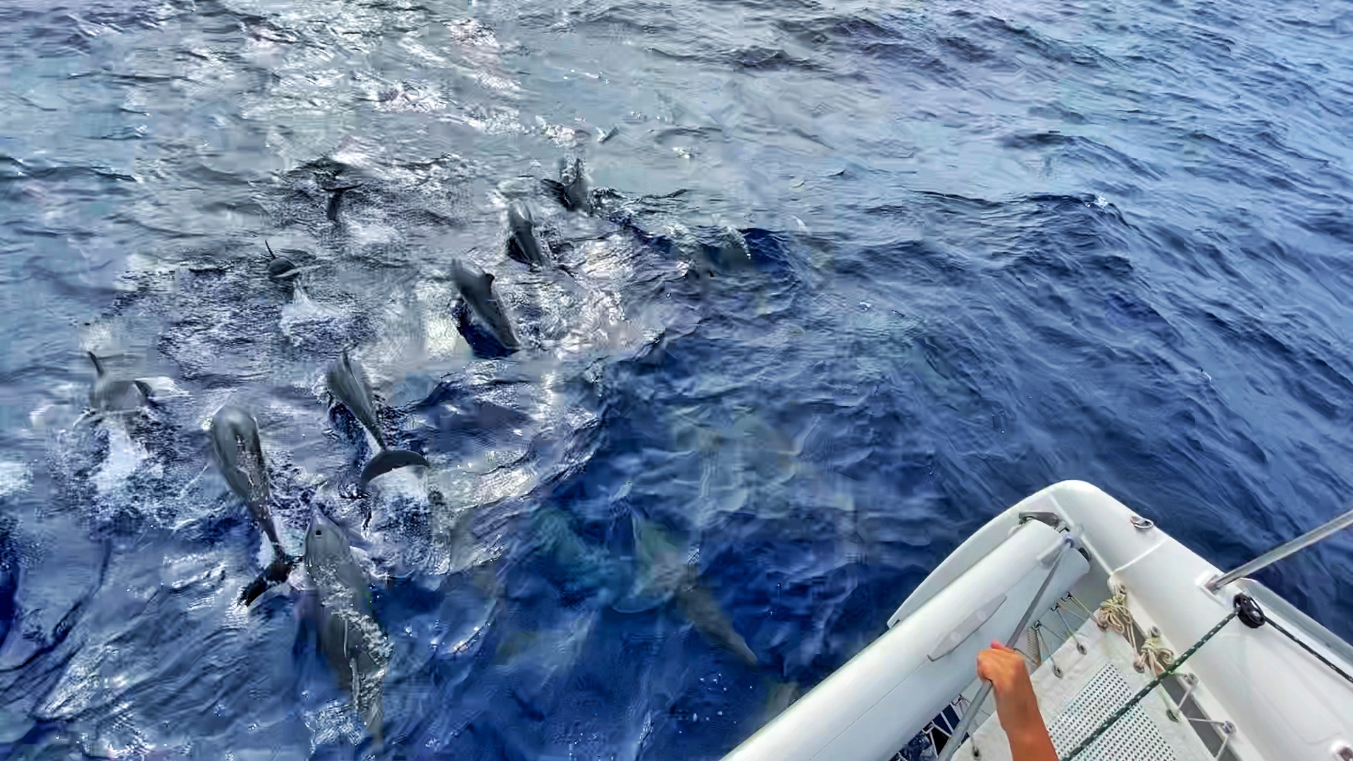
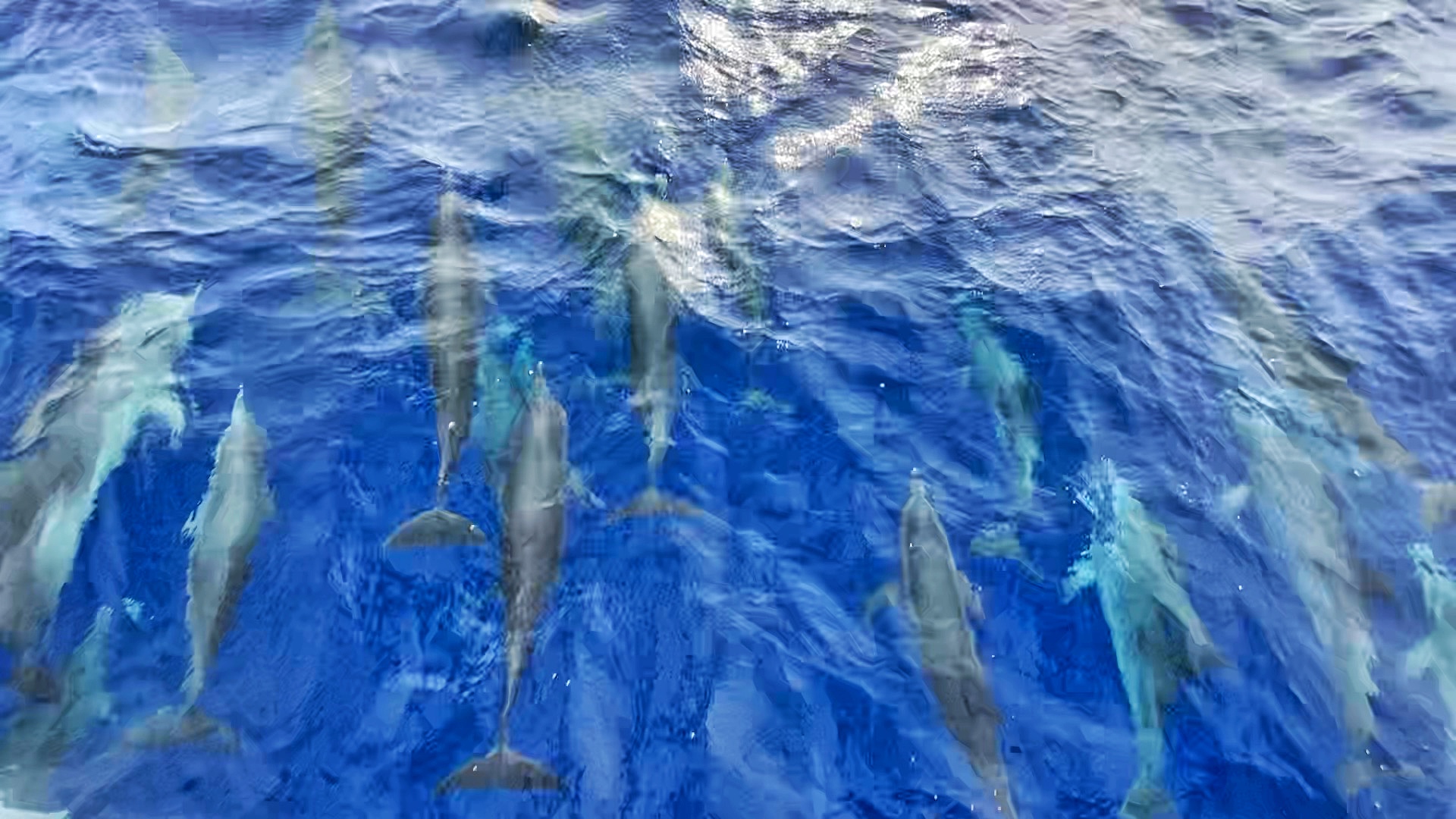
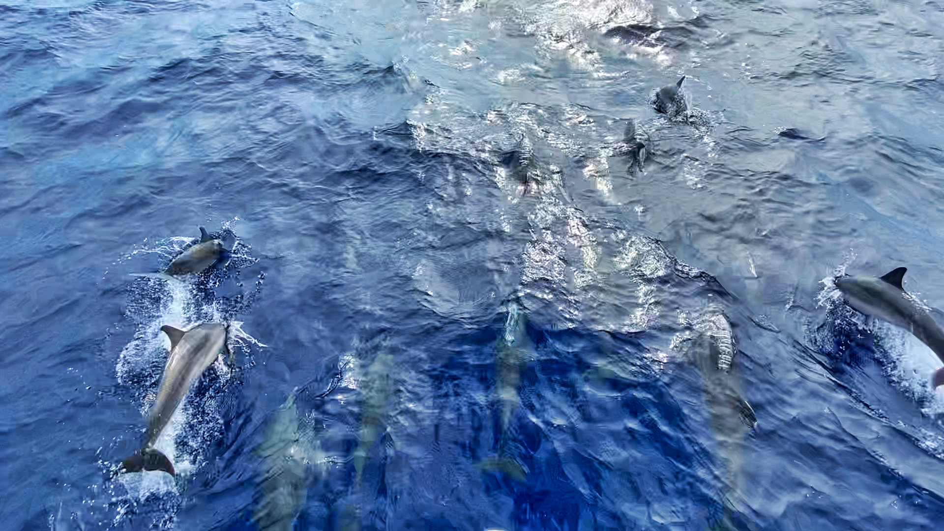
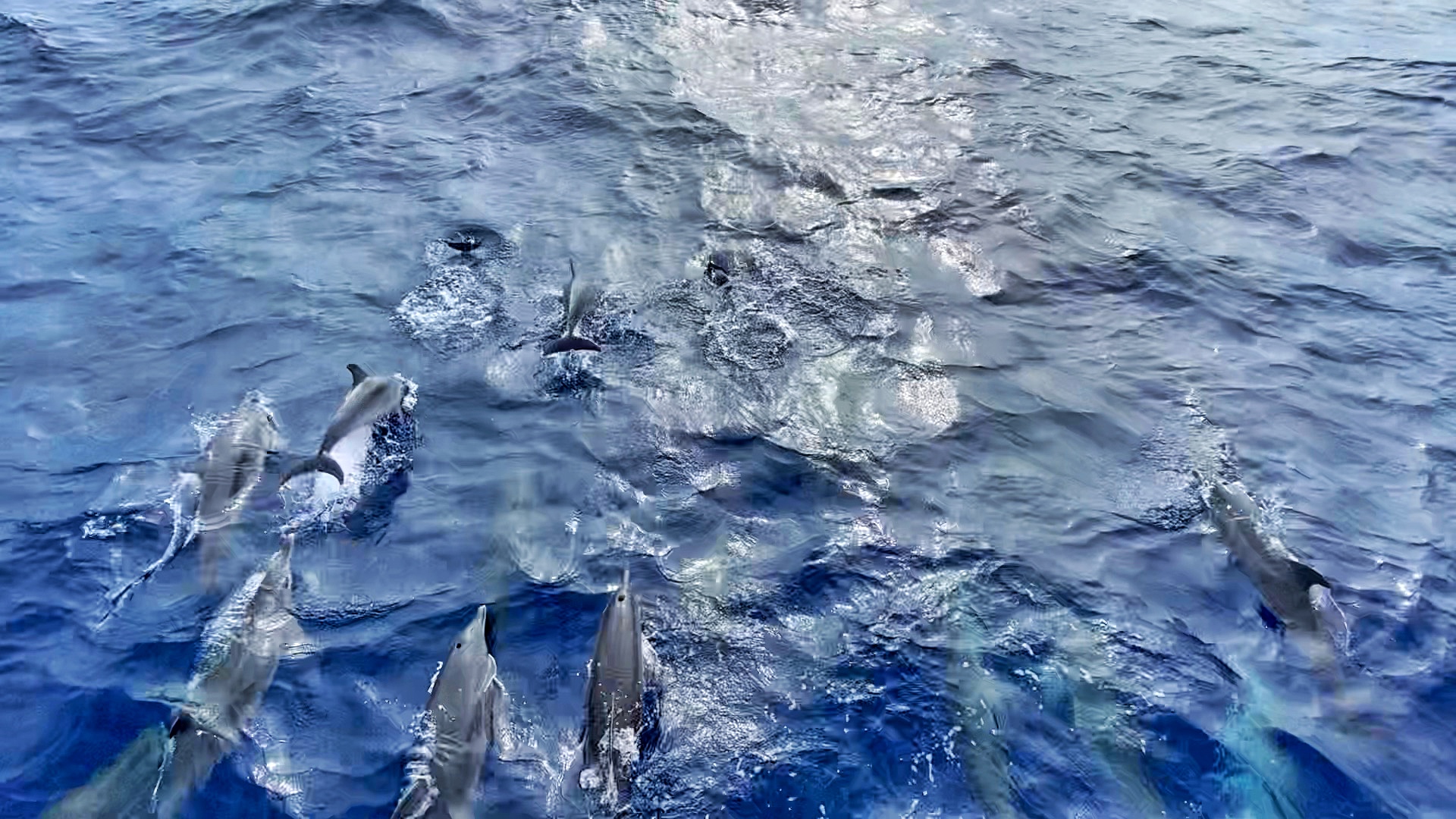
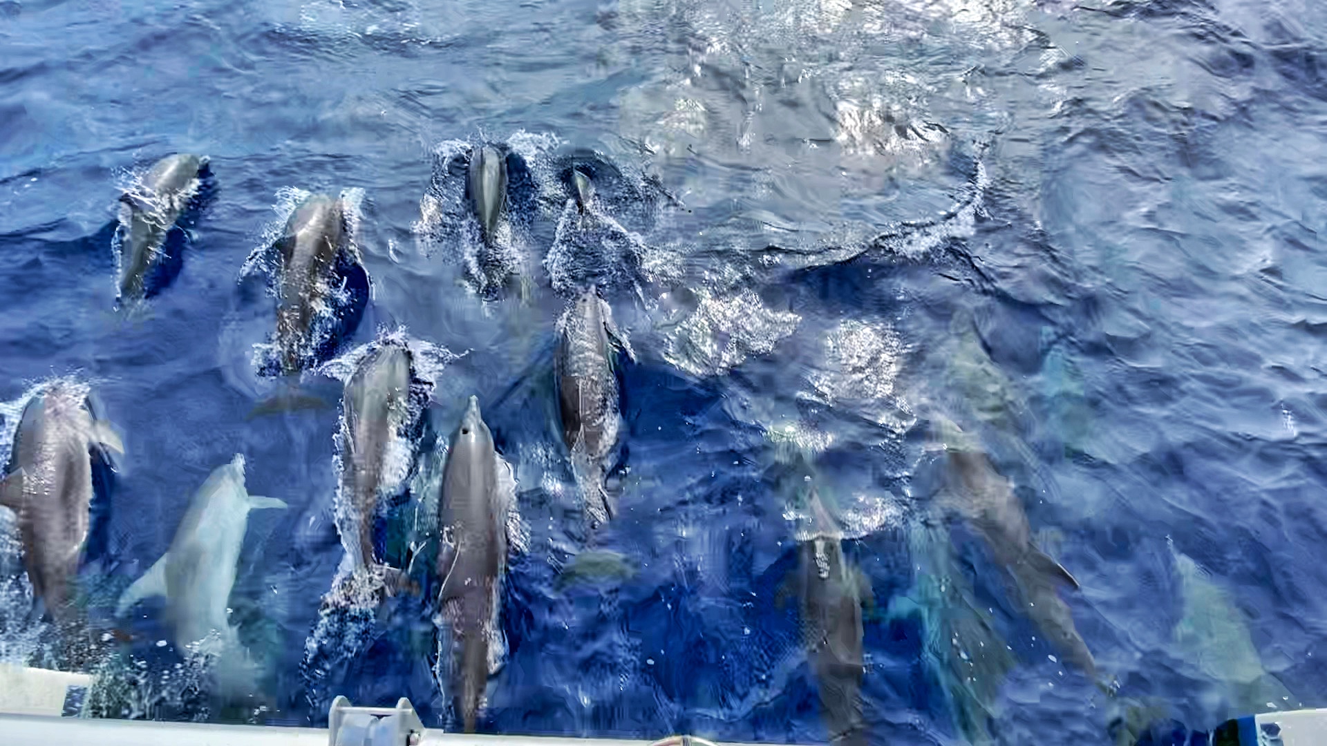
We have a special place in our hearts for this particular type of dolphin – the Atlantic Spotted Dolphin. You may recall we had an incredible experience swimming and playing with a small pod of these dolphins at Conception Island in the Bahamas. Ever since – we’re huge fans! This is our second time already this season spotting them, so we have high hopes for the coming months!
St Croix has bio-luminescent jellyfish
We are feeling pretty exhausted upon arrival at St. Croix, making a harrowing approach into our destination anchorage even more annoying. Traveling through the Bahamas last season, we got pretty comfortable carefully traversing really shallow waters, but it’s never fun to see less than 3 feet of depth on our sounders. Luckily, Matt kept us off the bottom!
Tangent: The draft of a boat is the depth that it sits under water – so the distance from the water line to the lowest point on the bottom. Our boat draws (or has a draft) somewhere between 4-4.5 feet. We’ve never taken the time to really measure it, and it will depend on how much it’s weighted down at the time. To be conservative, we just tell everyone 4.5 feet. The depth sounders tell us how deep the water is below us, but the sounders are located on the bottom of the hulls rather than at the top of the water. This means that our depth sounders actually understate the depth of the water by around 2 feet. We know we typically hit bottom (or run aground) when the depth sounders read somewhere around 2.2 feet – don’t ask how we know.
After making it through the skinny entrance, we drop the hook in about 12 feet of water – plenty of depth now. The sun is starting to set at this point, so we launch the dinghy and take Monster to the beach to enjoy the last of the daylight. After darkness sets in, we head off towards another bio-luminescent bay. We know it’s supposed to be the bay in the northeast corner – of course, there are two bays here. I choose one to explore first – no bio-luminescence to be seen. After a few minutes, we see a small kayak tour heading towards the other bay. Apparently, I chose wrong.
We slowly follow the kayaks into the next bay – switching over to paddling and turning off the dinghy engine. I hate paddling the dinghy, but am rejuvenated when I spot a flash of green light in the water. It’s not a tiny speckle either – it’s the size of a golf ball. I think we’ve found the bio-luminescent jellyfish I read about! We keep going, and before too long we are spotting some sparkles in the water, and every once in a while the bright green glow of a jellyfish. As we get further into the bay, they become more abundant. I’ve read that these jellyfish don’t sting and you can actually hold them in your hand. I’m not sure how anyone knows this though, because we sure couldn’t get close to catching one in our hands – and not for lack of trying!
Eventually, we decide we should head back to our boat and make some dinner. We’re both feeling pretty happy with our decision to visit this bio bay – much better than the one on Vieques. Of course the timing was in our favor, as we were just a couple days before a new moon. The jellyfish are really something special, though! Unfortunately, we couldn’t capture any photos of these magical creatures.
Our first overnight
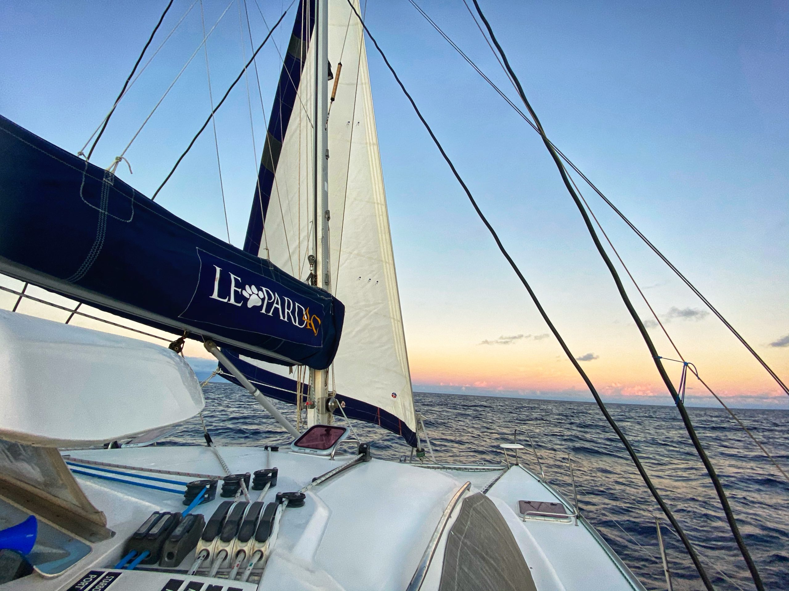
We spend a lot of time weighing our options on how to best get to St. Martin from here. We have over 100 miles to go and the past two days have been slow going traveling into the wind and waves. The weather looks much better the following day and a half for our crossing to St. Martin, but we’re still not sure what to expect in terms of speed. We are pretty certain we will have to travel at dark – during some part of the journey. Ultimately, we decide to do our first overnight passage.
We leave St. Croix around 3pm, heading east towards St. Martin. The waves have calmed down a LOT making it feel much more manageable from the start. Our plan is to arrive at the anchorage in St. Martin right at sunrise – or if we make good time, we can try anchoring in the dark and getting some rest. The timing becomes extra tricky in this case because we want to get inside Simpson’s Bay – a large protected lagoon. This requires going through two draw bridges – each of which only opens a couple times per day. Combine this with the fact that you’re supposed to check in with customs and immigration immediately upon arrival, but we want to check in on the French side of the island, on the other side of both bridges – well, it gets complicated. More on the French vs Dutch side of St. Martin (or St Maarten) in the next post!
It feels very strange to see the sun setting mere hours into our passage. Normally, the sun is setting as we are arriving somewhere – not the opposite. We try to relax and enjoy the pretty view. Shortly after, we start to see the stars coming out. That is one thing we’re really enjoying tonight – star gazing. There is a new moon, so the sky is pitch black except for the stars. You never notice how many stars can really be seen until you’re out somewhere like this. We also spot two satellites going across the sky, which is pretty exciting. One thing we weren’t expecting is how far off you can still spot different pieces of land (i.e. islands) due to the light pollution. We can spot St Thomas from here and it doesn’t take too long before we are spotting St. Martin so many miles off in the distance.
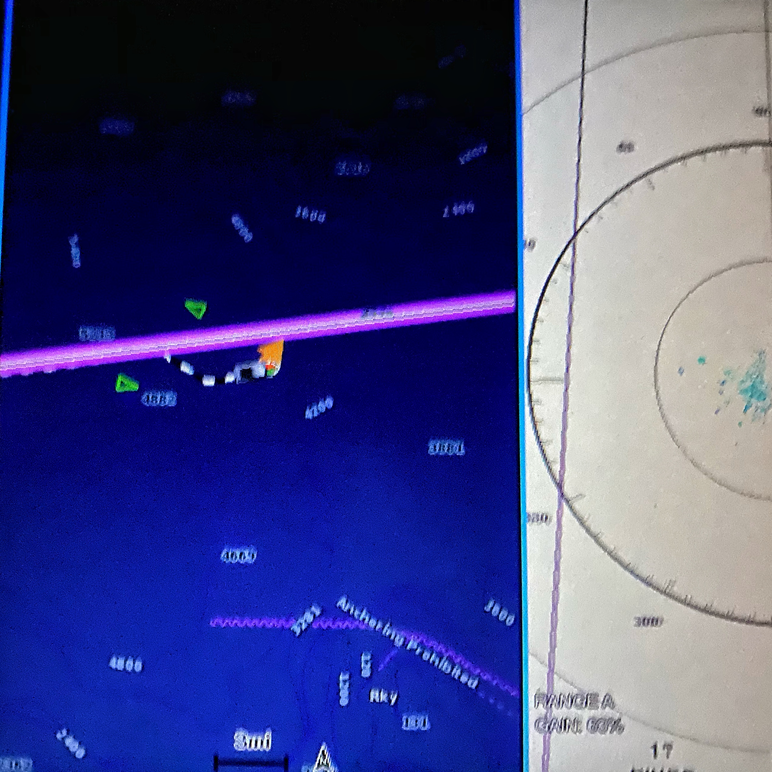
After several hours, we decide to take shifts so that each of us can relax and hopefully nap a bit. We’re feeling pretty comfortable at this point. It’s amazing how much our eyes adjust to the darkness. Plus, we are finally putting our AIS and radar to use!
Tangent: AIS stands for Automatic Identification System. In many cases this will be equipped on vessels – especially larger ones. This allows vessels to electronically see each other from a distance, helping aide in navigation and of course avoiding collision. Some AIS are only receivers – which basically means you can see other vessels but your vessel isn’t broadcasting (so other vessels can’t see you). Other AIS are receivers and transponders (i.e. see others and can be seen) – this is what we have. It’s fun because we see a small triangle pop up on our chart plotter – indicating a vessel. We can then click on that vessel and see information such as their name, position, course, and speed (among other things). Then there is also radar, which helps identify vessels (actually any objects) regardless of how the vessel is equipped. This is important because not all personal vessels will have AIS – or won’t be broadcasting. It doesn’t give you all the additional information, but it is simple and tells you when something is around. Radar can also be used to help identify land and storms – among other things. There is a long debate about what is better to have – AIS or radar. We’re happy to have both!
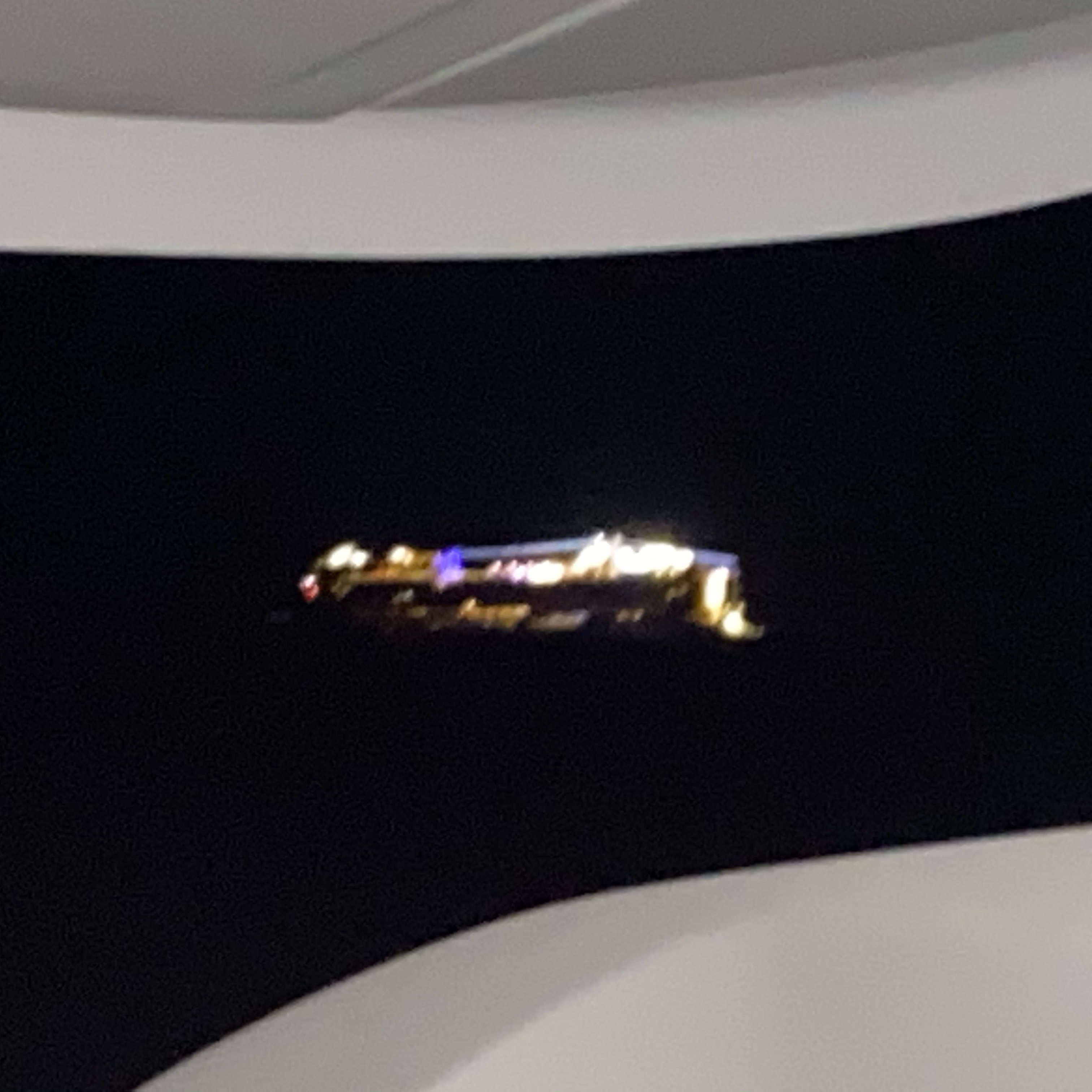
Matt’s shifts seem to be boring without much going on, but that’s not the case for me! A mere minutes into my second 2-hour shift, I see a vessel pop up on the AIS. Upon further investigation, I can see that it is a cruise ship, the Norwegian Epic. I’m pretty sure based on the international maritime rules, I would be the stand-on vessel, meaning the cruise ship should go around me. However, in the basic sense rules, I’m a small vessel and I’m going to get well out of the way of the floating city. To be fair – the cruise ship seemed to turn course a bit too, helping us pass port to port (i.e. left side of boat to left side of boat). During this time, I can also spot another ship off in the distance behind us. Initially I didn’t think their course was going to come close to us – but that’s what happens when other vessels are traveling 3x our speed. Using the AIS indicates it is yet another cruise ship! I adjust course further so that I can stay in-between the two ships and carry on my way. We never actually got *close* to either ship, but it was still a bit nerve wrecking being the first overnight and encountering cruise ships. Below is a screenshot of our chart plotter. The two green triangles are the cruise ships and the other boat shape is us (and no, the shapes are not to scale).
I am feeling pretty energized after the cruise ship encounter – and a little jealous of the nice meals everyone must be eating on-board. I am ecstatic, though, when I spot a dolphin off the starboard side. You know it has to be really close for me to see it in the dark with no moonlight. I spot a second one, but they both swim ahead towards the bow. There is a very good chance there are more dolphins swimming under our bow, but with Matt napping, I am stuck to the helm and can’t investigate. We both agreed ahead of time that no one was allowed on the bow unless they were wearing a life jacket and the other person was actively watching them. It doesn’t seem worth waking Matt up for this, so instead I turn on our underwater lights and am able to catch a few more dolphins swim by in the distance. Hey, still pretty good!
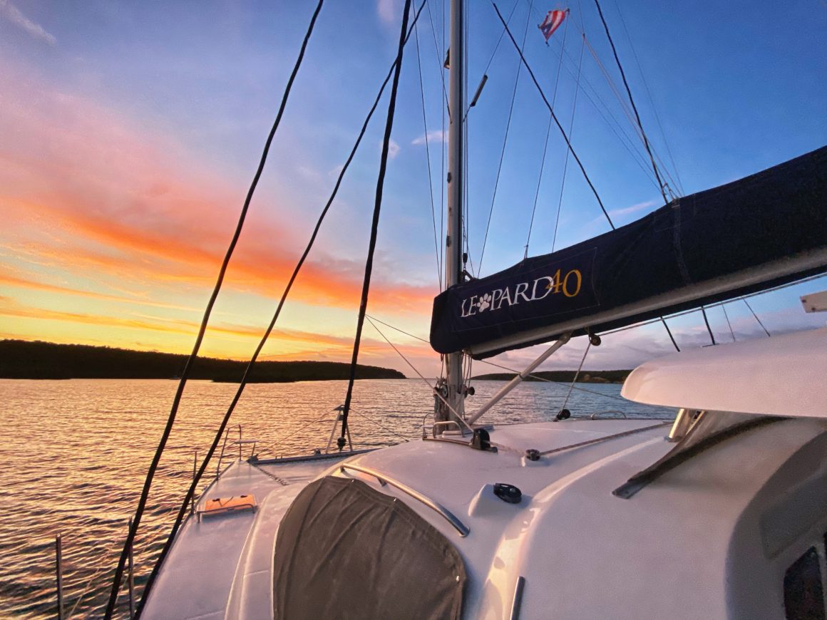
We make decent time, arriving before sunrise. Initially we decide to slow down to wait for sunrise to anchor, but then we realize it won’t be for another hour and a half – so we just head in. The anchorage is very large, and there are very large ships anchored in the area. It isn’t too hard to find an open spot to drop the hook and get a couple more hours rest before the scheduled bridge opening.
We made it. First overnight complete.